
PROGRESS MEETS NATURE: Battling tides between development and conservation in Leganes town
By Ma. Joie Hegaylershe Casidsid
By Ma. Joie Hegaylershe Casidsid
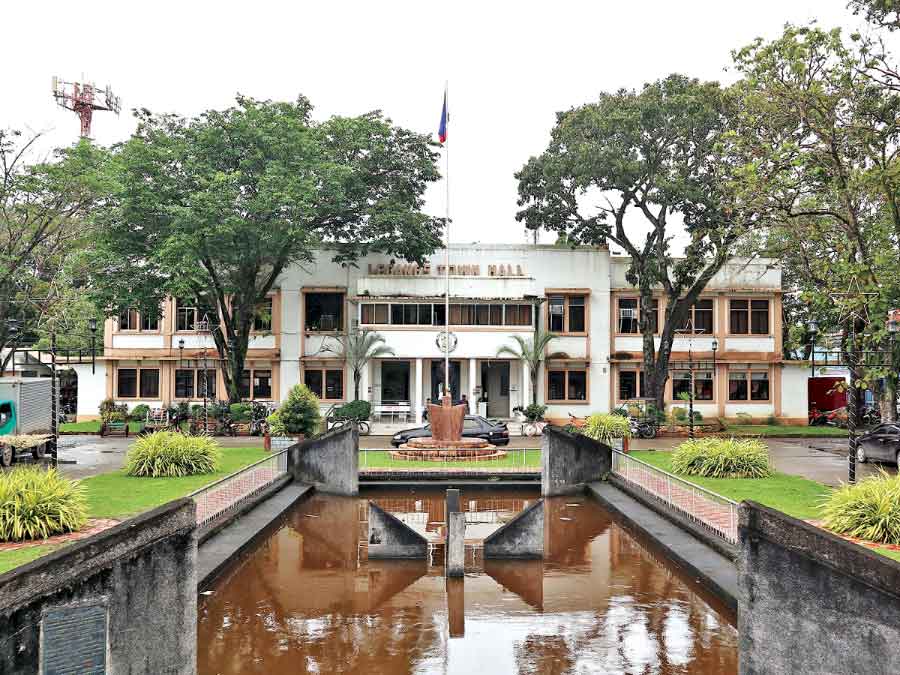
In the quiet municipality of Leganes, Iloilo—a town once recognized for its agricultural productivity and its proximity to Iloilo City—a silent threat is steadily growing.
The land is gradually sinking, and the waters are persistently rising. What were once seasonal floods have become more frequent, more destructive, and increasingly treated as a normal part of life.
A combination of climate change, unregulated urban development, and ground subsidence is steadily turning this low-lying municipality into one of the most at-risk areas in the Philippines’ ongoing climate crisis.
A 2024 study published in the International Journal of Applied Earth Observation and Geoinformation confirms that Leganes is not alone. Ground subsidence—the gradual sinking of land due to natural or human-induced causes—has been recorded in several major areas in the Philippines.
Iloilo has been identified as among the most vulnerable areas. This slow but consistent land sinking worsens the impacts of coastal flooding and storm surges, especially in communities such as Barangay Poblacion, Leganes—specifically by 2.6 millimeters per year—where the proximity to rivers and the sea makes adaptation both urgent and complex.

In response to these threats, the Department of Public Works and Highways (DPWH) has begun constructing a concrete river wall along the creek at Brgy. Buntatala, Leganes, designed to protect lives, properties, and essential infrastructure.
While this project has been praised as a necessary step, experts caution that hard infrastructure alone offers limited and temporary protection.
A National Broadcasting System news article (2017) implies that while floodwalls may delay the entry of water, they cannot prevent long-term damage unless paired with comprehensive environmental planning and sustained community involvement.
This perspective is supported by the Institute of Contemporary Economics (2024), which urges the public to look beyond alarming headlines such as “Iloilo is sinking.”
According to the institute, the focus must shift toward evidence-based planning and adaptive strategies.
For Leganes, this means moving beyond reactive measures and embracing climate resilience approaches that integrate scientific knowledge and local community needs.
The urgency of the situation is clear.
Rising waters are no longer a distant threat.
They are revealing critical weaknesses in policy, infrastructure, and governance.
Across many vulnerable areas in the Philippines, including Leganes, “excessive groundwater extraction, rapid urbanization, and the natural compaction of deltaic sediments have emerged as key factors that cause yearly land subsidence,” based on a Rappler article.
These factors collectively intensify flooding risks and complicate efforts to manage the impacts of climate change.
As such, the following breakdown will focus on how the first two factors contribute to subsidence and what this means for adaptive planning and resilience building in affected communities.

Flooding in Poblacion remains a persistent challenge, especially in low-lying areas such as around Leganes Central Elementary School.
The school grounds often become waterlogged during heavy rains, disrupting classes and affecting student safety.
“Despite multiple interventions, flooding here remains a recurring issue,” says Hon. Paul J. Krafft, Barangay Captain of Poblacion—a statement that echoes the growing frustration among residents.
Architect II Harold Hopilos of the Municipal Engineering Office explains that Leganes’s drainage systems were originally built for a smaller population and a more agricultural setting.
“These were designed when open fields could naturally absorb water,” he notes.
However, as the town urbanized with subdivisions, paved roads, and commercial areas, the land lost its permeability.
The outdated infrastructure now struggles with increased runoff, causing frequent street and residential flooding.
Hopilos stresses that addressing this is not just about expanding canals but rethinking how the town manages water amid rapid development and climate pressures.
Echoing this concern, and based on a 2024 article from Manila Standard, Jessica Dator-Bercilla, an expert in disaster resilience, emphasized the need to avoid excessive conversion of land into concrete.
She explained that impermeable surfaces block rainwater from seeping into the ground, which not only increases surface flooding but also prevents the replenishment of groundwater supplies.
Preserving permeable areas, she added, could help mitigate both flooding and land subsidence in vulnerable communities like Leganes.
Supervising Environmental Management Specialist Cheryl Fernandez of the Municipal Environment and Natural Resources Office (MENRO) points to the compounding factor of improper waste disposal.
“Clogging caused by waste disposal further impedes drainage,” she said, emphasizing how even moderate rains cause excessive flooding when drainage paths are blocked.
Capacity and Maintenance Issues of Drainage Canals
The drainage canals throughout Poblacion have suffered from decades of neglect and physical obstruction.
Architect Hopilos recounts, “Many canals are narrowed due to silt buildup and structural obstructions, reducing their ability to channel water effectively.”
Hopilos also highlights that ongoing widening projects—such as the drainage line from Leganes Central Elementary School to Cagamutan Norte—aim to adapt the system to current demands.
“The volume of water now exceeds what the drainage can handle,” he said, explaining that original canal dimensions are insufficient.

Fernandez further clarifies the role of waste: “Clogging from garbage is one of the reasons the water overflows,” illustrating that even if canals are properly sized, the accumulation of plastics, food waste, and sediment restricts flow.
Community cleanup efforts have had some success, but inconsistent participation and enforcement create setbacks.
Bridging Infrastructure and Ecosystem-Based Approaches
Despite visible efforts like river dredging, Poblacion still lacks comprehensive flood control systems such as diversion canals.
Hopilos explains, “There have been plans proposed, but coordination between agencies remains a challenge. Sometimes we only learn about projects when they’re already in motion.”
His observation highlights persistent gaps in planning and communication among key stakeholders, which delays critical interventions.
Meanwhile, Fernandez underscores the importance of natural buffers: “We revived the mangrove area, which helps reduce the impacts of storm surges and sea level rise.”
The rehabilitation of the abandoned mangrove ecopark after Typhoon Frank restored ecological balance and provided a natural layer of defense.

However, Fernandez adds that natural systems alone cannot manage the increasing risks posed by urban expansion and heavier rainfall.
A more integrated approach—one that aligns engineered structures with environmental conservation—is crucial to safeguarding Leganes’ most vulnerable communities.
Urban Expansion and Disruption of Natural Water Systems
Rapid residential development, especially the rise of subdivisions like Deca Homes, has fundamentally altered Poblacion’s natural drainage patterns, as opened up by Hon. Krafft.
Architect Hopilos expounds, “The irrigation canals connecting the farmlands were concreted and narrowed,” changing from open canals to confined drainage pipes that are less capable of handling heavy runoff.
Rainwater that once filtered through agricultural fields now rushes along paved roads, overwhelming narrow drainage pipes and causing flash floods.
Fernandez stresses that collaboration with agencies like the National Irrigation Administration (NIA) is critical: “We need to cooperate with the NIA to rehabilitate the drainage.”
However, conflicting land uses—agriculture converting to residential—have led to incomplete and fragmented infrastructure upgrades.
The narrowing of irrigation canals due to recent concretization reduces flow capacity, causing water to back up during storms.
Waste Handling Difficulties and Environmental Consequences
Waste accumulation remains a stubborn problem contributing to clogged canals and worsening floods.
Fernandez notes, “Garbage clogs the drainage, especially residual waste that is not properly segregated.”
Despite the presence of enforcers and designated dumping areas, irregularities persist: “When there is an enforcer, people don’t dump illegally; but when there isn’t, some still throw garbage even in small areas.”
One tangible example is the drainage line along the road near the municipal market, where plastic bags and food wrappers frequently accumulate, blocking water flow and causing flooding that affects vendors and customers alike.

segregate correctly, resulting in large volumes of mixed garbage.
Regular cleanup drives improve conditions temporarily, but sustained education and stricter enforcement are needed to change behavior.
Groundwater Use and Its Impact on Land Stability
Most households in Poblacion now rely on Level 3 water systems, which has reduced dependence on deep wells—commonly linked to land subsidence.
Fernandez explains, “There are still deep wells, but they are only used for flushing and cleaning; they are no longer potable.”
Although over-extraction of groundwater is recognized as a significant factor worsening land subsidence and damaging roads and infrastructure, residents generally do not consider deep wells as a viable water source.
Architect Hopilos points out, “Subsidence damages roads and drainage lines, increasing flood risk.”
These structural issues necessitate costly repairs and complicate long-term flood management plans.
Both officials emphasize the need to integrate groundwater regulation with urban planning to mitigate future risks.
Tracing Flood Sources
A case in point, Leganes Central Elementary School has long endured persistent flooding that disrupts classes and reflects broader infrastructure and governance gaps.
Despite its central location, the school sits at one of the area’s lowest points, making it a natural catch basin for water from surrounding rice fields and irrigation canals.

“The school floods not because of internal drainage problems,” said Louinne Grace Insular, Master Teacher I and Officer-in-Charge of the school. “It’s the overflow from the farmlands and irrigation behind the school. The water has nowhere else to go.”
The school lies just below a stretch of agricultural land. During heavy rains, water from these fields pours into the school grounds, overwhelming the nearby canal. The road outside sits at a higher elevation, directing runoff into the campus rather than away from it.

The municipal drainage system adds another layer to the problem. It often lies lower than the floodwater during peak rainfall, preventing effective discharge. Even moderate storms can inundate the school.
A particularly vulnerable point is the open canal near the school’s old gymnasium. This canal cannot be improved because the adjacent land is privately owned and has not been formally donated to the school.
As a result, the school is unable to build flood-control measures or a perimeter fence that could help secure the campus against further flooding. Without legal ownership, the school remains unable to act on necessary improvements.
So far, the school has implemented stopgap measures. The floors of Grade 1 and some Grade 2 classrooms were elevated through support from the Local School Board of the municipal government.
A raised walkway was built using the school’s Maintenance and Other Operating Expenses (MOOE). A former fishpond at the back of the school was filled with garbage to raise the land and reduce water retention.
The school’s primary water source is Metro Pacific Iloilo Water, a Level 3 system, although it still operates two deep wells for cleaning and watering purposes.
Some residents have blamed trash for the flooding, but Insular insists that is not the root cause. “The trash is not the problem. It is the water from the outside that the canals cannot handle,” Insular said.
Interestingly, the school is classified under a low flood hazard level according to data from the University of the Philippines’ Nationwide Operational Assessment of Hazards (UP NOAH) Center.
UP NOAH is a nationwide disaster management program aimed at enhancing the country’s capacity to respond to extreme weather conditions.

However, areas within the vicinity of the school are already marked under medium flood hazard levels. This discrepancy between mapped risk and lived experience highlights the limitations of broad-scale assessments when local drainage and land elevation issues are not fully addressed.
One wider drainage challenge in Poblacion is that stormwater from upland barangays such as Lapayon and Cagamutan Sur converges at lower points like the school.
Architect Hopilos noted that NIA Road often becomes a bottleneck, worsened by canal blockages and poor flow design.
A new drainage project toward the Janipaan River via C2 Road is underway but remains limited by available funding.
To address the problem sustainably, several steps are needed, according to Insular.
The privately owned land behind the school must be formally donated to allow construction of a perimeter fence and canal improvements.
Additionally, the town’s drainage system should be re-evaluated and upgraded.
The situation in Barangay Poblacion is a microcosm of a larger dilemma faced by many areas in Iloilo, especially in the city: Where does development end and conservation begin—and can the two ever truly meet?
In theory, sustainable development seeks to strike a balance. But in reality, one side often outweighs the other.
Economic expansion—through housing projects, commercial zones, and road networks—frequently overshadows efforts at environmental preservation.
The flooding and the blocked canals are not just consequences of natural forces but of decisions that favor short-term growth over long-term resilience.
If Leganes is to thrive amid the worsening climate crisis, it must rethink its priorities.
Infrastructure must adapt, waste management must improve, and urban planning must become both forward-looking and inclusive.
The waters are rising—not just in rivers and canals but also in urgency.
The challenge now is not merely to stay afloat, but to change course before the tide becomes irreversible.
References
Bennington, J. (2017, July 26). Walls Won’t Save Our Cities From Rising Seas. Here’s What
Will. NBC News. https://www.nbcnews.com/mach/science/walls-won-t-save-our-cities-rising-seas-here-s-ncna786811
Cadiz, N. (2018). UP NOAH in Building Resilient Philippines; Multi-hazard and Risk Mapping
for the Future. ScienceDirect. https://doi.org/10.1016/j.proeng.2018.01.131.
Daily Guardian. (2023, December 13). DPWH builds concrete river wall in Leganes, Iloilo to
protect livelihood and properties from flood. https://dailyguardian.com.ph/dpwh-builds-concrete-river-wall-in-leganes-iloilo-to-protect-livelihood-and-properties-from-flood/
Delilan, A. (2024, August 30). Iloilo City mayor skeptical, wants more scientific studies on
‘sinking’ report. Rappler. https://www.rappler.com/philippines/visayas/iloilo-city-mayor-jerry-trenas-skeptical-wants-more-studies-sinking-report/
NOAH – Nationwide Operational Assessment of Hazards (n.d.). Hazard Level.
https://noah.up.edu.ph/know-your-hazards
Institute of Contemporary Economics. (2024, September 2). ILOILO IS SINKING!: A Sober
Look at the Headlines and its Implications. https://dailyguardian.com.ph/iloilo-is-sinking-a-sober-look-at-the-headlines-and-its-implications/
Lozada, C. (2024, August 28). Experts warn Iloilo City could become the “Next Venice” amid
rapid land sinking. Manila Standard. https://manilastandard.net/?p=314490008
Municipality of Leganes. (n.d.). Barangay Poblacion. https://leganes.gov.ph/barangay-poblacion
Murga, A. (2022, October 12). How to restore PH’s lost mangrove forest? An Iloilo town shows
the way. Rappler. https://www.rappler.com/environment/leganes-iloilo-shows-way-how-restore-philippines-lost-mangrove-forest/
Sulapas, J. J. S., Ybañez, A. a. B., Marasigan, K. M. M., Grageda, J. M. B. M., & Lagmay, A.
M. F. A. (2024). Ground subsidence in major Philippine metropolitan cities from 2014 to 2020. International Journal of Applied Earth Observation and Geoinformation, 133, 104107. https://doi.org/10.1016/j.jag.2024.104107
Comments (0)
LEAVE A REPLY
No comments yet
Be the first to share your thoughts!


